
If the true location of the French Fort Caroline is on the Altamaha River near Darien, Georgia and not the St. Johns River near Jacksonville, Florida (as I argued here and here) then this presents a question: where was the original Fort St. Augustine? According to the Spanish general Pedro Menendez, it required two days of marching in order to reach Fort Caroline. If the original Fort St. Augustine was near modern-day St. Augustine this would simply not be enough time to march the required distance. Yet eyewitness accounts of the location of the original Fort St. Augustine clearly state that it was meant to be a temporary location until a better location could be found thus suggesting it was not originally at present day St. Augustine. Below are the written accounts pertaining to the location of the original fort or encampment:
Pedro Menéndez de Aviles: The Adelantado
“I sent on shore with the first 200 soldiers, two captains, Juan Vincent a brother of the Captain Juan Vicente,and Andres Lopez Patino, both old soldiers, in order to throw up a trench in the place most fit to fortify them selves in, and to collect there the troops that were landed so as to protect them from the enemy if he should come upon them. They did this so well that when I landed on Our Lady’s Day to take possession of the country in your Majesty’s name, it seemed as if they had had a months time, and if they had had shovels and other iron tools, they could not have done it better, for we have none of these things, the ship laden with them not having yet arrived. I have smiths and iron, so that I can make them with dispatch, as I shall. When I go onshore we shall seek out a more suitable place to fortify ourselves in, as it is not fit where we are now. This we must do with all speed, before the enemy can attack us, and if they give us eight days more time, we think we shall do it.” Pedro Menendez de Aviles translated by Henry Ware “Letters of Pedro Menendez de Aviles”, Massachusetts Historical Society Proceedings VIII:419-425.
This account clearly shows that the original Fort St. Augustine or encampment was only temporary and never meant to be the permanent location of their fort. Thus the academic consensus that Fort St. Augustine was always located in modern-day St. Augustine is not supported by the account of the Spanish founder of St. Augustine. The original fort or encampment could literally be anywhere but we know it must be no further than a two day’s march to Fort Caroline.
Gonzálo Solis de Méras: The Captain and Brother-in law
“As soon as he reached there (the harbor of St. Augustine) he landed about 300 soldiers and sent two captains with them, who were to reconnoiter that daybreak the next morning the lay of the land and the places which seemed to them strongest (for defense), in order that they might dig a trench quickly while it was being seen where they could build a fort…” (Gonzálo Solís de Méras, Connor translation p. 89)
This account confirms that the original encampment was not the same as the fort that would be built later. The encampment was where the soldiers launched their assault on Fort Caroline from. Thus there is no requirement that it be located in modern-day St. Augustine. The original fort could very well have been located at modern-day St. Augustine while the encampment could have been much closer to Fort Caroline.
Francisco López de Mendoza Grajales: The priest
“They went ashore and were well-received by the Indians, who gave them a very large house of a cacique which is on the riverbank. And then Captains Patiño and San Vicente, with strong industry and diligence, ordered a ditch and moat made around the house, with a rampart of earth and fagots…” (Father Francisco López de Medoza Grajales, Lyon translation 1997:6.)
It’s unclear if Grajales is talking about the encampment or the fort. This account places the original encampment or fort at an Indian village which the Spanish comandeered. The “ditch and moat” were built around a large council house likely similar to the reconstruction at the Mission San Luis site in Tallahassee, Florida.
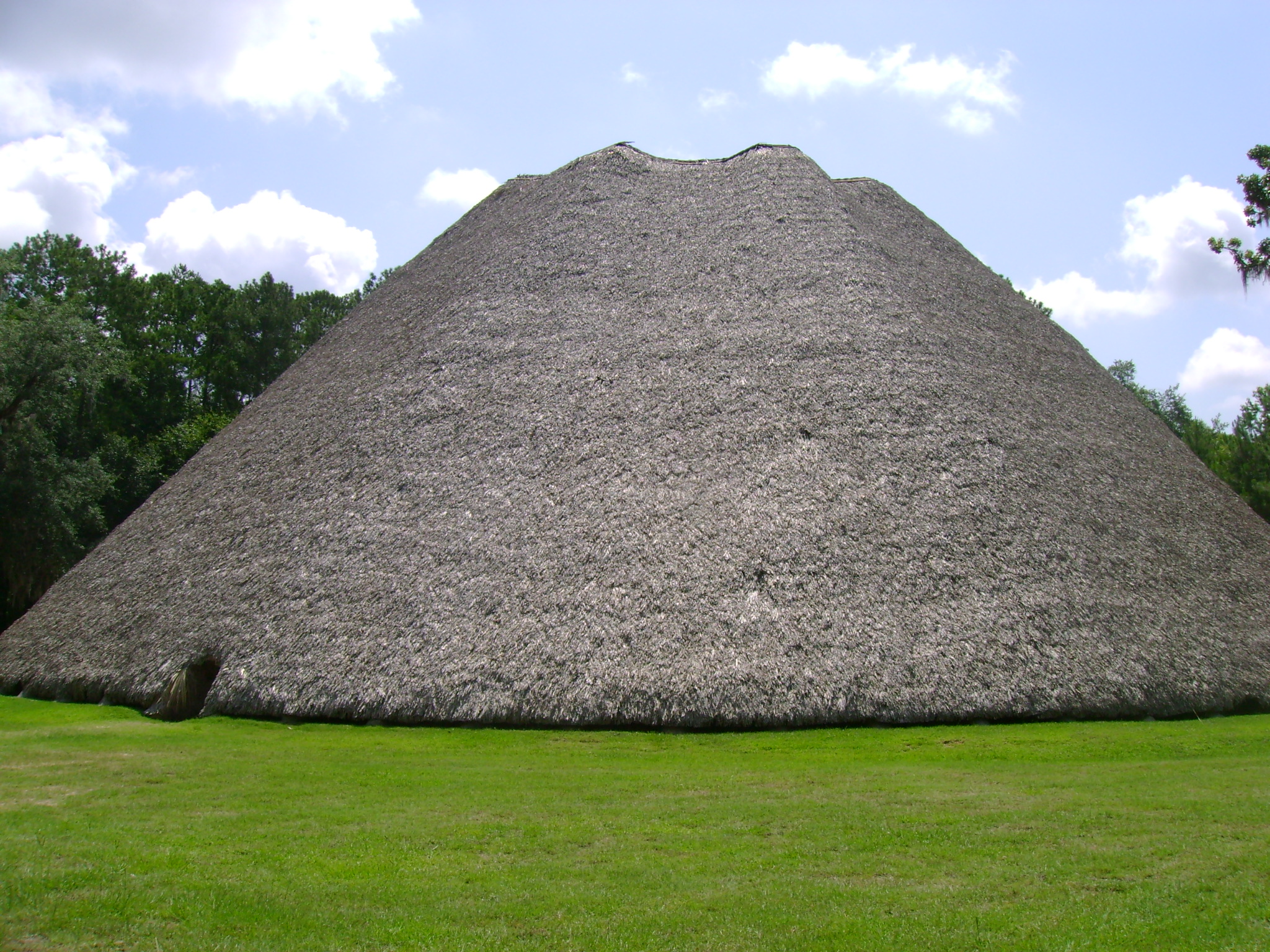
Reconstruction of the Native American council house at the Mission San Luis site. (c) 2008, Gary Daniels
Renee de Laudonniere- French commander of Fort Caroline
(The Spaniards) “went on shore at the River of Seloy, which we had called the River of Dolphins. [Jean Ribault] “had been informed by King Emola, one of our neighbors arriving during our consultations, that the Spaniards had gone ashore in great numbers and had seized the houses of Seloy and used them for their Negroes whom they had brought to do labor. He said that they now lodged themselves on the land and had made protective trenches around themselves” Rene de Laudonniere- pp. 158-159 in Bennett, C. 2001, Three Voyages University of Alabama Press, Tuscaloosa.
From this account we learn that the Spaniards were not likely as “well received” by the Indians as the Spanish priest had suggested but instead “seized the houses” of the Indian town of Seloy by force of arms. This also suggests the priest in the previous account was referring to the encampment. (Unless, of course, the Spanish seized Indian villages for the location of both the encampment and the fort which is quite possible.) We also learned that the original fort or encampment was on the River of Seloy/River of Dolphins.
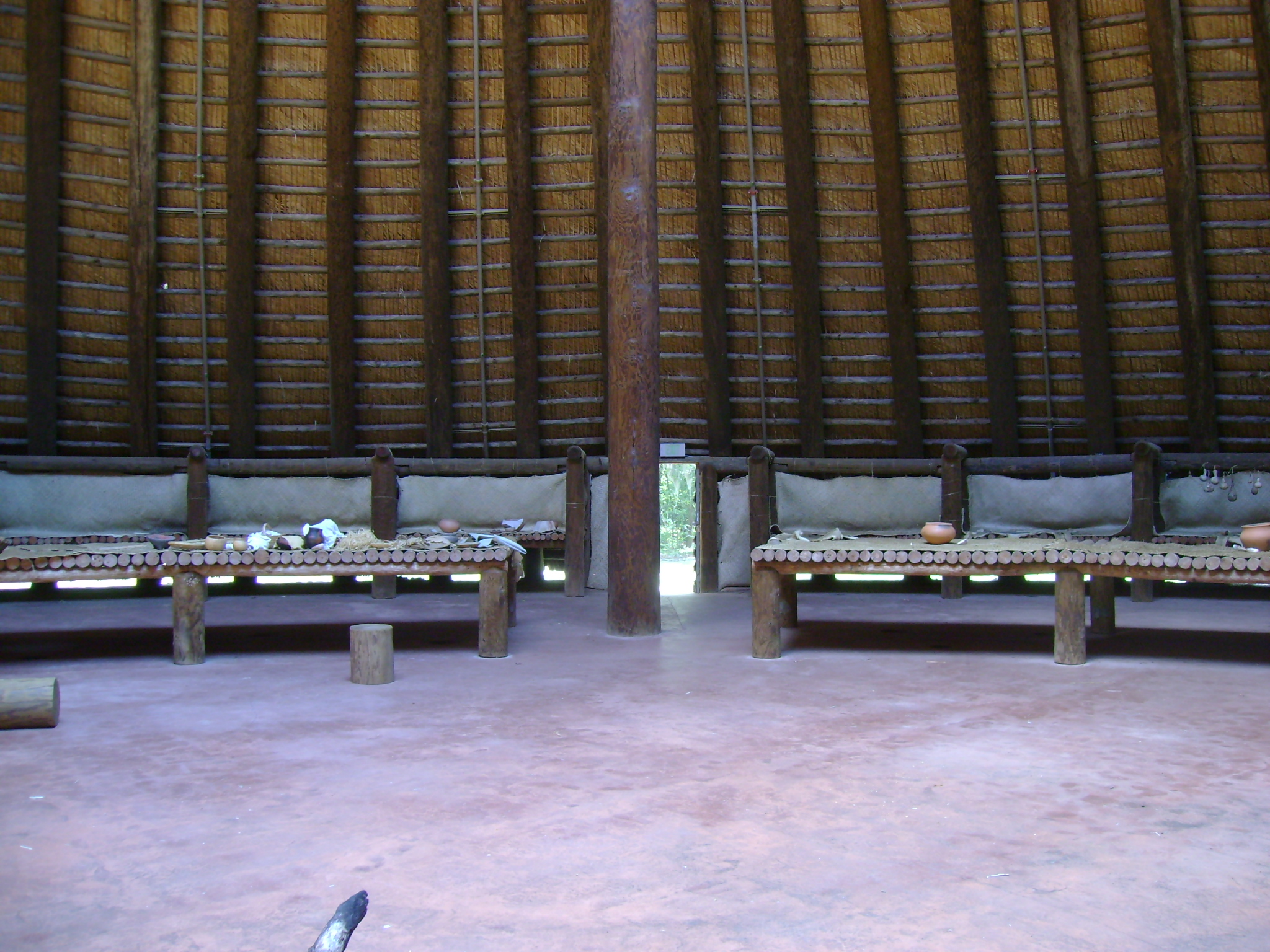
Small section of the interior near the low doorway of a reconstructed council house at Mission San Luis in Tallahassee, Florida.
Captain Cossette- French captain
“M. DE Ribault, — Yesterday at four, p.m., a Spanish fleet of eight ships hove in sight, six of which cast anchor near us. Seeing that they were Spaniards, we cut cables, and made sail; and they immediately made sail in chase, and pursued us all night, firing many guns at us. Finding, however, that they could not come up with us, they have made a landing five or six miles below, putting on shore a great number of negroes, with spades and mattocks. On this state of facts, please to act as you shall see fit.” Narrative of Le Moyne
From this account we learn that the encampment was constructed “five or six miles below” Fort Caroline. Most likely the translator meant “leagues” not “miles” and since one French league equals approximately 2.9 miles this results in a distance of 15-18 miles. Eighteen miles south of the Altamaha Sound would bring one to between the St. Simons Sound and St. Andrews Sound. The St. Andrews Sound is the entrance to the Satilla River.
Jacques le Moyne- French artist/map maker of Fort Caroline
“All the troops being now on board, a fair wind for an hour or two was all that was needed to bring us up with the enemy ; but just as the anchors were about to be weighed the wind changed, and blew directly against us, exactly from the point where the enemy were, for two whole days and nights, while we waited for it to become fair. On the third day, as signs of a change appeared, Ribault ordered all the officers to inspect their men ; and M. d’Ottigny finding in his examination of Laudonniere’s force, that I was not yet quite cured, had me put into a boat along with another soldier, a tailor by trade, who was at work on some clothes for him against the proposed return to France, and sent us, against our wills, back to the fort. But just as they had weighed anchor, and set sail, there came up all at once so terrible a tempest that the ships had to put out to sea as quickly as possible for their own safety ; and, the storm continuing, they were driven to the northward some fifty miles from the fort, where they were all wrecked on some rocks, and destroyed. All the ships’ companies were, however, saved except Capt. La Grange, a gentleman of the house of the Admiral dc Chitillon, a man of much experience and many excellencies, who was drowned. The Spanish ships were also wrecked and destroyed in the same gale.” Narrative of Le Moyne
This account notes that it only took “an hour or two” to reach the location where the Spanish were disembarking. We also learn that the French ships were “driven…northward some fifty miles from the fort” and were “wrecked on some rocks, and destroyed.” This completely contradicts modern academic consensus that the French crashed south of modern-day St. Augustine near Matanzas inlet. If Fort Caroline was on the Altamaha then these ships were wrecked somewhere near the southern end of Tybee Island although I’m unaware of any rocks at this location. This could be a mistranslation and the distance may be fifty leagues not miles which would equate to 150 miles or somewhere between Beaufort and Charleston, South Carolina.
It is also possible the reference to crashing “north” was a misstatement and Le Moyne meant “south.” In that case, 150 miles south of the Altamaha River would have the French crashing just south of modern day St. Augustine, Florida. This would match historical records that the French survivors were slaughtered by the Spanish at nearby Mantanzas (Spanish for “slaughter”) so named because of this slaughter.
We also learn that the Spanish ships were also wrecked and destroyed by this storm thus research into the locations of old ship wrecks in this area might prove fruitful.
More From Pedro Menendez
Menendez had more to say about the location of the fort. He notes:
The River San Mateo, running by the Fort we captured, goes seventy leagues inland and turns to the southeast emptying into the bay of Juan Ponce, …On this river are three large Indian towns… This Port is 29 1/2 degrees, and the San Mateo which we captured is 31 degrees. The French and their pilots were mistaken. I have had it taken by the sun on land. From here to the Cape of Canaveral there are fifty leagues, three rivers, two ports; between here and Havana, one hundred leagues, more or less, which are navigable in boats among the keys of Canaveral and Los Martyres, and from there to Havana.
Menendez’s description that the river “goes seventy leagues inland and turns to the southeast emptying into the bay of Juan Ponce” describes neither the Altamaha nor the St. Johns River. Traditionally, the Bay of Juan Ponce is shown on old maps in southwest Florida. Yet this doesn’t seem to be the same location that Menendez referred to as the Bay of Juan Ponce. In another letter, Menendez described the Bay of Juan Ponce this way:
“I now ask that 300 may be here in the sourse of April, and it would be well that 200 more should be sent in the month of October, for the settling of the Bay of Juan Ponce, for the river of the fort of St. Matthew which we took from the enemy goes 60 leagues inland within this Bay, and by means of this river we shall easily communicate from one sea to the other. The multitude of Indians there are there will be thus sooner brought to the knowledge of our Holy Catholic Faith, for, in this Bay of Juan Ponce, is the province of Apalache an indomitable people, with whom the Spaniards have never been able to effect anything and as this province is level, we can easily pass over as far as New Gallicia, which may be about 300 leagues distant about as far to Vera Cruz, and about as much farther to Honduras and to Yucatan.”
It’s clear from the passage above that the Bay of Juan Ponce referred to by Menendez was not the one in southwest Florida but instead was located in northwest Florida which is where the “province of Apalache” was located. His Bay of Juan Ponce was either Apalachee Bay or Appalachicola Bay. The fact that Menendez mentioned that this province was flat and made it easy to pass overland to New Gallicia and onto Vera Cruz, located on the Gulf Coast of Mexico, further confirms he is discussing northwest, not southwest, Florida.
His knowledge of this river seems to come directly from Fontaneda, a Spanish shipwreck survivor who lived in La Florida for 17 years and was likely rescued after the Fort Caroline assault. As noted in “Quest for Fort Caroline,” Fontaneda’s account of the River San Matteo on which Fort Caroline was located is consistent only with the Altamaha River not the St. John’s River. Apparently Menendez believed that when traveling west from the coast up the Altamaha/Ocmulgee River system that when it turned south at the Big Bend area it continued on to the Chattahoochee and ultimately to the Appalachicola Bay- his “Bay of Juan Ponce.” (Of course, it doesn’t. It loops back north and heads towards Macon, Georgia instead.)
Also, the above English translation of Menendez’s account includes an error. The original Spanish records noted that “this Port is 29 1/2 degrees, and the San Mateo which we captured is [treinta y un cuarto] 30 1/4 degrees” not the “31 degrees” cited in the mistranslation. If by “This Port” Menendez was referencing the location of Fort St. Augustine and not the encampment then the location would closely match the location of modern-day St. Augustine which is located at 29.80 degrees. Yet his location of Fort Caroline at 30 1/4 degrees would more closely match the St. John’s River which is located at 30.40 degrees. It appears that this is the strongest evidence academics can site for the location of Fort Caroline being on the St. John’s River. Yet all the eyewitness written accounts simply do not support this conclusion thus we either have to discard all the eyewitness accounts…or one faulty latitude reading. Considering that scholars have pointed out how unreliable latitude readings are from this time period, it would seem most logical that the latitude readings were incorrect and not every single eyewitness written account.
Furthermore, if by “this Port” Menendez meant modern-day St. Augustine then one has to account for the “three rivers and two ports” he claimed existed from there to Cape Canaveral. The geography between these two locations consists of a nearly unbroken coastline of white sand beaches. Only two inlets exist along this coastline: Matanzas Inlet south of St. Augustine and Ponce Inlet near New Smyrna Beach. Yet there are indeed three rivers and two ports south of the Satilla River in Georgia and Cape Canaveral: the St. Mary’s River, Nassau River, and St. John’s River plus St. Augustine Inlet and Ponce Inlet. (Matanzas Inlet has never developed into a port over all these years thus Menendez likely recognized it wasn’t port material when he left it out of this accounting of ports.)
Conclusions
Based on these accounts it is clear that the Spanish encampment from which they attacked Fort Caroline was not the same as the fort which they would build later called St. Augustine. Thus the insistence by academics that the Spanish attacked Fort Caroline from modern-day St. Augustine is simply not supported. This encampment could be anywhere but we know it must be no further than a two-days march from Fort Caroline. If Fort Caroline was on the Altamaha River near Darien, Georgia then this encampment could be no further south than the Satilla River. Thus the recent assertion by two academics (who announced the “discovery” of Fort Caroline on the Altamaha River after it had already been published here and elsewhere at that location) that the encampment was on the St. Marys River is simply not supported by the available eyewitness accounts. Nor is it supported by old maps which place the Indian village of Seloy on the River of Dolphins, a river shown on these maps as flowing east from near a Lake Sarope (likely the Okeefenokee Swamp) to the coast without any course changes along the way. The St. Marys River makes major course changes along its route from the Okefenokee Swamp to the coast first flowing south then north then east before finally reaching the coast. What evidence these academics used to conclude that the River of Dolphins was the St. Marys is unknown but the known written accounts and maps simply don’t support this conclusion. I guess they’ll have to wait until independent researchers find the actual location of this encampment before they can announce their “discovery” of it.